Cirrus (Ci)
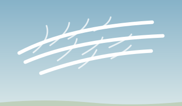
Curl of hair
Thin, feathery ice-cloud streaks. Watch the trend: spreading and thickening high cloud can signal a changing weather pattern, but cirrus alone does not promise a front.
 The Flight Deck
WEATHER 02 / LEARN · EXPLORE · CHECK
Read the shape of the sky and ask what is happening vertically.
Picture a small parcel of air nudged upward. It expands and cools. If it becomes colder and denser than its surroundings, it tends to sink back: stable air. If it stays warmer and less dense, it can continue rising: unstable air. Compare the parcel with the environment, not just one surface temperature.
Unsaturated rising air cools about 3°C per 1,000 feet. Saturated air usually cools more slowly because condensation releases heat; that rate varies. The standard atmosphere’s roughly 2°C per 1,000 feet is a reference, not today’s measured profile.
An inversion means temperature increases with height. It resists convection but can coexist with wind shear or mechanical turbulence. Stable does not mean harmless.
Lift air by heating, terrain, convergence, or a front. As it cools toward saturation, droplets can form on condensation nuclei. Dew point is the temperature at which air becomes saturated when cooled at constant pressure without changing its water-vapor content.
Cloud names are a short description of shape, height, and precipitation. Learn the pieces and a long word becomes a useful picture.
Put it together: cirro + stratus = a high layer. Alto + cumulus = middle-level heaps. Cumulo + nimbus = a towering precipitation cloud: a thunderstorm.
Original recognition sketches based on FAA Aviation Weather Handbook, Appendix A: Cloud Types; compare them with National Weather Service cloud photographs. Compare shape, texture and growth; the sketches do not establish a cloud’s actual altitude or clearance.
These height families are a guide, not fixed flight levels. Actual heights vary with latitude and season. Use reported bases and terrain elevation when planning cloud clearance.
Curl of hair
Thin, feathery ice-cloud streaks. Watch the trend: spreading and thickening high cloud can signal a changing weather pattern, but cirrus alone does not promise a front.

High layer
A thin veil that can produce a halo around the sun or moon. Look for lowering or thickening layers as the system evolves.
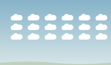
High heaps
Small white grains or ripples, sometimes called a mackerel sky. They describe high-level structure, not proof of an approaching thunderstorm.

Middle layer
A gray or blue-gray sheet; the sun may look dim, as through frosted glass. Watch for a thickening layer and deteriorating conditions along the route.

Middle heaps
Rounded patches or rolls, often with shading. Turreted altocumulus castellanus—castle-like tops—suggests instability aloft; check the convective forecast rather than assuming storms are certain.

Layer
A low, fairly uniform gray blanket, sometimes with drizzle. For a private pilot, a low base can squeeze the space available between terrain and clouds.

Layered heaps
Low rolls or rounded clumps joined into a broad patch or layer. Breaks between clumps do not guarantee a usable route or adequate cloud clearance.
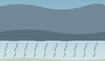
Precipitation layer
A thick, widespread sheet producing persistent rain or snow. It can extend through several levels with a low base and ragged cloud below. Plan for reduced visibility and obscured terrain; do not force it into one altitude band.

Heap
Separate puffs with flat bases and rounded tops. Cumulus humilis means low or humble: shallow fair-weather-looking puffs. Keep watching whether they stay small or grow.

A growing heap
Cumulus congestus means piled up: tall cauliflower towers. This is strong convection, not a separate one of the ten main types. Give developing cells room and consider changing the route or departure time.
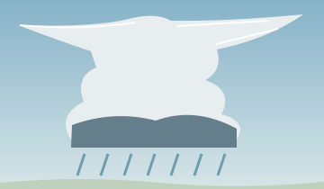
Precipitation heap
A deep thunderstorm cloud, often with a fibrous top or anvil. Avoid the storm and its outflow; hazards extend beyond the visible cloud and rain.


Lenticular means lens-shaped. Smooth, stacked lenses near mountains can mark standing waves. The cloud may appear stationary while strong wind flows through it; wave and rotor turbulence can extend into clear air.
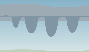
Mammatus describes hanging pouches, from a word meaning breast or udder. Often seen below an anvil, these are a cloud feature, not a separate main type or proof of a tornado. Assess the parent storm and keep your distance.
Fractus means broken: ragged cloud fragments, often beneath a larger layer or in precipitation. They are a warning that cloud bases and visibility may vary quickly along the route.
For every cloud, ask three cockpit questions: Can I stay clear with terrain margin? Is visibility deteriorating? Is the cloud growing? A cloud name alone cannot establish a safe route or a smooth ride.
Radiation fog: overnight surface cooling chills moist air, commonly with clear skies and light wind. Sunshine may help disperse it, but not on a guaranteed timetable. Advection fog: moist air moves over a colder surface; it can persist with wind.
Upslope fog: moist air cools as terrain forces it upward. Steam fog: cold air mixes with moisture from warmer water. Precipitation fog: evaporating rain moistens cooler air. Ice fog consists of suspended ice crystals in very cold air.
A small temperature/dew-point spread increases concern when cooling or added moisture is expected. It does not prove fog will form. Check observed trends and the forecast through arrival, not just departure.
FLIGHT SCENARIO
A coastal airport has steady onshore wind and low visibility. Inland temperatures are warmer. A passenger says, “The breeze will clear the fog.” What is missing?
Wind can feed advection fog by carrying moist air over a cold surface. Check the coastal temperature pattern, observations, and forecast. Do not make departure or diversion plans depend on sunshine or wind clearing the field.
SUMMARY
Wind can feed advection fog by carrying moist air over a cold surface. Check the coastal temperature pattern, observations, and forecast. Do not make departure or diversion plans depend on sunshine or wind clearing the field.
Before moving on, explain the decision in your own words: what would you verify, and what would make you change the plan?
PRACTICE
Six flashcards, then five questions with explanations.
Enable JavaScript for flashcards and the knowledge check. The lesson and scenario remain available without it.
Curriculum framework: the supplied Weather Theory and weather products documents. All scenarios are educational examples, not current weather. Content reviewed September 2026.